Mark Foley's DIT Lecture Notes:
Geographic Information Systems
Repository for all things GIS-related. Further details on the module can be found here. This is the "official" syllabus which doesn't change too often. The module as delivered will be adjusted to reflect advances in the body of knowledge and the technologies associated with the subject.
This page provides access to notes and other material that we'll be using in class. The module content is built around the idea of "topics". These correspond roughly but not exactly to weeks. In other words, we may not finish a topic in any given week or we may cover more than one topic in any given week.
This list will be expanded as the semester progresses.
"Sales Pitch" that I sometimes give to students thinking of taking the module
Brief introduction to simple GIS concepts
Brief outline giving some idea of what we'll be covering during the module
Topics
- Spatial Data
- Spatial data modelling
- Data Analysis
- Spatial data storage and representation
- Input, editing and validation
- Advanced GI modelling
- Workflows and introduction to GIS programming
- Maps and cartography
- Alternative GIS software
- Data Quality Issues
- Path and Network Analysis
Reading List
 |
An Introduction to Geographical Information Systems (4th Ed.) Ian Heywood, Sarah Cornelius, Steve Carver. Prentice Hall (2012) ISBN: 978-0273722595 This is the main course text. We will be mostly using material from this, at least initially. We will also be using material from other sources including, but not limited to, those listed below. |
 |
Introduction to Geographic Information Systems (5th Ed.) Kang-Tsung Chang. McGraw-Hill, (2010) ISBN: 978-0071267588 |
 |
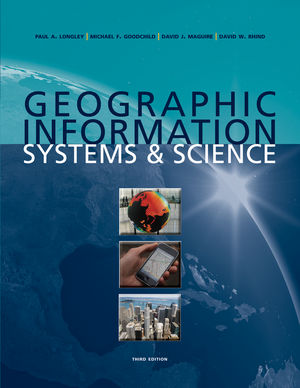
Geographic Information Systems and Science (3rd Ed.) Paul A. Longley, Mike Goodchild, David J. Maguire, David W. Rhind. Wiley (2010) ISBN: 978-0470721445 |
 |
Geospatial Analysis Michael J. de Smith, Michael F. Goodchild, Paul A. Longley. Troubador Publishing Ltd (2006) ISBN: 978-1905886609 |
 |
Python Geospatial Development (2nd Ed.) Erik Westra Packt Publishing (2013) ISBN: 978-1782161523 |
|
|
Practical hands-on experience using GIS software will be provided using ArcGIS from ESRI. |
Other Interesting Resources
QGIS
QGIS (previously known as "Quantum GIS") is a cross-platform free and open-source desktop geographic information systems (GIS) application that provides data viewing, editing, and analysis capabilities.
Similar to other software GIS systems, QGIS allows users to create maps with many layers using different map projections. Maps can be assembled in different formats and for different uses. QGIS allows maps to be composed of raster or vector layers. Typical for this kind of software the vector data is stored as either point, line, or polygon-feature. Different kinds of raster images are supported and the software can perform georeferencing of images.
QGIS provides integration with other open source GIS packages, including PostGIS, GRASS, and MapServer to give users extensive functionality. Plugins, written in Python or C++, extend the capabilities of QGIS. There are plugins to geocode using the Google Geocoding API, perform geoprocessing (fTools) similar to the standard tools found in ArcGIS, interface with PostgreSQL/PostGIS, SpatiaLite and MySQL databases.
QGIS is a serious competitor to ArcGIS and it's free!